Hike Info Page
DO  NOT  CONTACT  THE  CHURCH   OFFICE 
TO  SIGN  UP  FOR  HIKES  NOR  FOR  INFORMATION

CONTACT  THE  HIKE  PLANNER  DIRECTLY
PLEASE NOTE CHANGES HIGHLIGHTED IN RED!
Updated 3-8-2007
Trip: Fort Mountain State Park / Gahuti Backcountry Trail
(Southern Side of Loop)
Date: Saturday, March 10, 2007
Trip Host: Jeremy Landers
770-861-8175
Location: Fort Mountain State Park
181 Fort Mountain Park Rd
Chatsworth , GA 30705

Murray County
Cost: Carry cash for fuel sharing & parking.
Difficulty: Moderate - Strenuous
Length: 5.6
Blaze: Orange
Departs From: 7:45am The Grace Center

8:00am Kroger, Thompson Bridge Road, Gainesville
(Far Left Side of Parking Lot)

8:20am Park & Ride GA 400 (Unless the indivdual meets us at Ft. Mt. We don't know yet.)
Departure Time:
Meals: Bring A Trail Lunch, water and snacks.

Dinner in Dahlonega afterwards
Transportation: We will be carpooling! (as of 3-8-07)

Bus
We will take the church bus providing we have enough people who wish to ride. An amount to be detremined will be charged to each rider for gas.

POV's with carpooling, or drive on own. If you need transportation you can post an email to the hike group email list.

(Always be prepared to drive your own vehicle if necessary. If you carpool, fuel costs should be shared.)

GPS Info:
USGS Quad: Crandall
Ranger District:
Schedule: 7:45am Depart the Grace Center

8:00am Depart Kroger Gainesville

8:20am Depart Park & Ride GA 400 Dahlonega??????

10:00am Arrive Fort Mountain State Park, Drop Car at trails end.

10:15am Restroom Break, Register to hike at Park Office

10:30am Begin Hike

12:30pm Lunch on trail

4:30pm Finish Hike, restroom break.

5:00pm Load bus and depart Fort Mountain State Park

6:30pm Dinner Dahlonega

8:00pm Drop Off at Park & Ride GA 400 Dahlonega??????

8:30pm Drop Off at Kroger, Gainesville.

8:45pm Return to Grace Center.

Schedule Subject to change. Allow time for the trip to take longer.
Trail Description: 
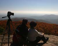
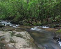
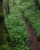
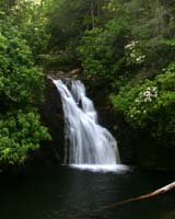
The portion of trail we will be hiking begins at the left of the entrance road to the park at a steep angle, it then climbs to an old road that runs along a ridge. The road gently descends into a hardwood forest. After a mile the trail climbs slowly for 0.2 miles. Just before the trail reaches a paved road, it turns left off of the roadbed. At 1.6 miles, the trail crosses a paved road. The trail then turns into a roller coaster alternating up and down. At mile 2.9, the trail crosses a stream and turns left onto Big Rock Nature Trail. The two trails share the pathway for a short while. After crossing the creek, the trail climbs away from the water. The trail levels off from here to mile 4.6, where it crosses the headwaters of Rock Creek. After crossing, the trail begins a long climb to a park road, then drops to an old roadbed, and then rises back to provide a great view of the Cohutta Mountains.
Notes:
Walk at your own pace!  Try to walk with someone when possible and try to stay in sight or sound of the main group which means the lead hikers may need to slow or stop to let the rear hikers catch up. This is a good reason to carry a whistle on you at all times. Lead hikers should stop at all trail intersections to let everyone gather before moving forward.

If you need a potty break while on the trail, just let someone know you are leaving the trail for a few moments and have that person wait nearby until you return. If you should feel ill or become weak while hiking, let Jeremy or Marsha know immediately. Do not push yourself forward on the trail under adverse conditions. One of us will work with you to maintain your safety. If you have any medical concerns that need to be known, be certain a hiking partner or Jeremy/Marsha know about any issues that could require immediate attention.

Carpoolers should share the cost of fuel when returning to their base location.

If you have any questions regarding the logistics for this hike, please contact Jeremy Landers. If you are signing up to hike or have transportation issues, contact Jeremy Landers.  More info on our hiking plans can be found at:  www.LandersStudions.com/gechike

PLEASE - DO NOT CONTACT THE CHURCH OFFICE REGARDING THE HIKES. THE CHURCH OFFICE DOES NOT HANDLE OUR PLANS NOR ROSTER FOR THIS ACTIVITY. CONTACT JEREMY OR MARSHA DIRECTLY.

Marsha:  Email
Jeremy:  jlanders@gracechurchgainesville.org or (770-861-8175 Cell)
Marsha
HIKE  AT  YOUR  OWN  PACE - BUT  HIKE  WITH  A  PARTNER  OR IN  SIGHT  OR  SOUND  OF  YOUR  GROUP  FOR  SAFETY.
Links & Ref. http://www.georgiastateparks.org/info/fortmt/
Photos
Map Park Map (Download PDF)

Road Map
Directions: From Dahlonega head west on Hwy 52 for approximatly 1hour & 20 min. Park will be on the right.
Reservations: Yes, Make Reservation with Jeremy /
770-861-8175 or Click Here To Email
Deadline to Sign Up: Wednesday March 7th, 2007

*Special Notice Regarding Hikers Under 18 Years of Age!

Post Trip Review: We had a great hike! Weather was perfect, views spectacular, and dinner afterwards hit the spot for a bunch of tired hikers.

*Special Notice Regarding Hikers Under 18 Years of Age!


Please take a moment to read the Participation Guidlines prior to hiking with the Grace Church Hike Group.

Additional Info For All Hikes
Information provided by Marsha Conner

ICE  INFO
(In Case Of Emergency)

We are now carrying ICE forms with us for safety. The hike planner will
be responsible for being sure these cards are on the trail.  A form in a
sealed yellow envelope with critical contact and medical data on each
hiker will be available in case of emergencies.  You are required to fill
out the emergency contact information however the medical information
is optional, should an emergency arise, this data would go with you for
medical treatment and provide contact information for your relatives
and medical information at the ER that should be known.  Many of us have
ICE phone numbers in our cell phones, but our cell phones may not work
in some wilderness areas.

WHAT  TO  CARRY
You should be self-sufficient on the trail. Do not plan to borrow items you
do not have from people hiking with you. They may not have what you need
or they may need it for themselves. Carefully look over the trail description and
map before going, ask questions, and make sure that you are physically able to
handle the terrain, the temperatures, the possible wetness, and the other
interesting things that might happen to us while on the trail! As always we
set our hiking pace to accomadate everyone. So don't think you'll be too slow.
Jeremy & Marsha are always willing to help you to be trail ready.

1.  Daypack
2.  Water/Fluid Supplies
3.  Food/Snack Supplies
4.  Cash and Photo ID (ID should be on your person at all times)
5.  Other Outdoor Supplies
6. 4 AA Batteries to use in our walkie talkies.

1.  Packs:
a.  Plan and pack for medical emergencies including
     blisters, bug bites, allergies, cuts, etc.
b.  At least one snake bite kit (Sawyer style) should be
     with the group (sold in most sporting goods depts).
c.  Weather change needs such as poncho, emergency
     blanket, cap, gloves, wind jacket, etc.
d.  Cell phone (in case it might work) and other
     items important to you for personal safety or comfort

2.  Water/Fluid Supplies
a.  Plan on carrying a cooler in your vehicle with ice to keep
food and fluids cold throughout the trip
b.  Carry enough fluid with you for the designated trail hike
c.  Do  Not  Drink  Water  From  Streams - most mountain
    water is no longer safe to drink as they may contain
    protozoan imps and make you very sick

3.  Food/Snack Supplies
a.  Short hikes may only require a light snack
     on the trail (1-2 miles) - plan accordingly
b.  Longer hikes usually require a moderate
     snack on the trail (3-4 miles) - plan accordingly
c.  Remember that your appetite is enhanced by
    being outdoors and doing physical activity

4.  Cash and ID
a.  Carry bills in different increments especially "ones"
     for park entrance fees and incidentals - each
     person is responsible for their own fees and should
     share any group cost for parking and fuel
b. The cost of fule is to be shared between driver and
passengers.
c.  For your safety, have your ID with you on the trail at
all times.
d.  Do not leave valuables in your parked car which you
    cannot afford to have stolen!

5.  Other Outdoor Supplies
a.  Camera, Flash Card(s) or film
b.  Binoculars
c.  Sun hat
d.  Knife and compass
e.  Extra socks if prone to blisters
f.  Bug spray
g.  Sting relief especially if you are
     allergic to insect stings
h.  Hiking pole or sticks
i.   Sweat towel and/or bandana
j. Large Pepper Spray (for animal attacks and personal protection)


6. Hunting Season
Remember your Blaze Orange During Hunting Seasons.

UPON RETURNING HOME

1.  Critical - Shower and check your body - CAREFULLY -
     for ticks (if a tick has attached itself to your skin, do
     not crush its body while removing it, but lift it away
     from your skin and pull out by the legs - treat the area
     properly and watch for any redness - if redness appears
     seek medical attention promptly)

2.  Clean and treat any wounded areas of your body -
     use ice for first 24-48 hours on joint/muscle injuries
     and heat as swelling subsides

3.  Consider keeping a log of your hiking experiences and
     write your story in a journal while memories are fresh

4.  Develop pictures and share copies with your hikers

GENERAL  GUIDELINES  TO  REMEMBER

1.  Leave pets at home if hiking with a group. More Info

2.  Keep groups on the trail to no more than 4-6 together

3.  Walk single file in the middle of the trail

4.  Step to the side of the trail as you go downhill
     to allow hikers going uphill to have the right of way

5.  Do not wade with your boots on unless necessary
     Wet socks and shoes can create immediate blisters

6.  Swift water can cause you to lose your footing in
     6-12 inches of water so do not be fooled that you
     can wade without danger across a stream

7.  Snakebites are a critical concern to hikers
     THINK before putting your hands and feet anywhere
     that might be a place of hiding for a snake:
     a.  Step on the top of logs - not over them
     b.  Use your hiking pole to check on the backside
          of logs and rocks before sitting down
     c.  Stay on the trail where visibility is better

8.  Read the many different theories on protection
     from bears and other wildlife - bears are most
     aggressive when protecting their cubs and stay
     near water and food sources frequently - bears
     do not "growl" but will make a "grunting" noise
     to let you know they see you when you may not
     see them - stop, back away slowly, and move
     back down the trail without hesitation - do not
     mistake a "grunting" noise for random woods noise
     on a trail as it may only be made one time to give
     you one chance to back away. Carry a large pepper spray.

9.  Let members of your hiking group know your intentions
    in case you decide to return to the parking lot or leave
     for the day. 

10. Remember that the GEC Open Hike each month will
     have a mixed skill level and cooperation as a team is needed.
     The monthly planner has volunteered to set up the hike
      and there may be slight differences with each hike.
      There is room for both the scenic hiker and the extreme
      hiker with good communication and proper planning.

More information on Hiker Safety can be found at the following websites.
Georgia State Park Safe Hiking Tips

http://www.redcross.org/services/hss/tips/hiking.html


Welcome | 2011 Hike Schedule | Special Events | Participation Guidelines | FAQ | Contact | Subscribe To Our Email List
Photo Gallery | Books | Links & Resources | Grace Episcopal Church Website

This Site Hosted By:
Jeremy R. Landers
&
Landers Photographic Arts

Please Help Support This Site By Visiting Our Webstore Today!

Home - Caricatures - Photography - Store - Search - Order Tracking - Customer Service - FAQ
Contact - About Us - View Shopping Cart - Registered Users Login


LandersStudios.com Landers Photographic Arts Ted Landers

Home of Landers Photographic Arts + Ted Landers Humorous Illustrator

Solution Graphics


Last Modified: Friday, January 9, 2009