| Data Updated: |
Thursday, October 20, 2011 8:08:02 PM |
| Trip: |
Appalachian Trail
Deep Gap, NC to Dicks Creek Gap, GA - Overnight Backpack Trip |
| Status: |
Confirmed & Planning
Trip is weather dependant. |
| Date: |
October 28 - 30, 2011
|
| Trip Host: |
Jeremy Landers
770-861-8175 |
| Location: |
Appalachian Trail
Rabun County GA
Clay County TN |
| Cost: |
Carry cash for fuel sharing & parking. |
| Difficulty: |
Moderate |
| Length: |
Complete Hike
15.6 Miles over three days
6.8 Miles on Day 1
4.5 Miles on Day 2
4.3 Miles on Day 3
Optional Day Hike Only
If you would like to hike with us from Deep Gap a couple miles in then turn around & head back this is an option which is open. If you are interested in this please let Jeremy know. You may need to provide your own transportation to NC to accomplish this depending on the number of hikers doing the complete hike and the plans of our car drop drivers. |
| Blaze: |
White Rectangle (Appalachian Trail) |
| Departs From: |
Quillians Corner Chevron |
| Departure Time: |
7:00 am Quillians Corner Chevron
|
| Meals: |
Bring adequate food for 2 breakfasts, 3 lunches, 2 dinners as well as any snacks. You should be prepared to properly store your food overnight to prevent critters & bears from getting your food supply.
(Click Here For A YouTube Video On How To Hang A Bear Bag)
Odor Proof Bags can be purchased at www.simpleoutdoorstore.com
These bags work great! |
| Transportation: |
POV's with carpooling, or drive on own. If you need transportation you can post an email to the hike group email list.
(Always be prepared to drive your own vehicle if necessary. If you carpool, fuel costs should be shared.)
Car Drop at Each Trail End |
| GPS Info: |
http://www.trimbleoutdoors.com/ViewTrip/1066370 |
| USGS Quad: |
|
| Ranger District: |
Chattooga Ranger Dist. Chattahoochee National Forest
Nantahala Ranger Dist. Nantahala National Forest . |
| Schedule: |
DAY 1
7:00am Meet at Quillians Corner Chevron
7:01am Dept. Quillians Corner Chevron
7:10am Meet at Frankhouser Home
7:20am Depart Frankhouser Home
7:30am McDonalds drive thorough window
8:20am Restroom break Moccasin Creek State Park.
8:30am Depart Moccasin Creek State Park
8:45am Drop vehicle(s) at Dicks Creek Gap Hwy 76.
8:50am Depart Dicks Creek Gap.
9:30am Arrive at intersection of Hwy 64 & Deep Gap Road
10:00am Arrive at Deep Gap Trailhead
10:15am Safety Briefing & Begin Hike
11:00am View To North (Day hikers turn back 2mile round trip hike)
11:45am Water Oak Gap (Day hikers turn back for 4 mile round trip hike)
12:30pm Intersection of Chunky Gal Trail
1:15pm Muskrat Creek Shelter (Privy), (LUNCH & optional views via side trail)
2:15pm Depart Muskrat Creek Shelter
4:30pm Bly Gap NC/GA State Line (CAMP)
--------Setup camp, filter water, cook supper, etc.... Bed!
DAY 2
8:30am Breakfast, Clean up Breakfast, Re-Supply Water, Break Camp, etc....
10:15am Depart Bly Gap
12:30pm Blueridge Gap
1:15pm Plumorchard Gap Shelter, Privy (LUNCH, CAMP)
--------Setup camp, filter water, cook supper, etc.... Bed!
DAY 3
8:30am Breakfast, Clean up Breakfast, Re-Supply Water, Break Camp, etc....
10:15am Depart Plumorchard Gap
12:00pm Cowart Gap (Approx. Day Hiker Meeetup Point)
1:30pm Dicks Creek Gap, Vehicles, HWY 76
1:45pm Depart Dicks Creek Gap
2:00pm Restroom break & late LUNCH Moccasin Creek State Park
2:45pm Depart Moccasin Creek State Park
4:00pm Quillians Corner Chevron
All times are approximate and are subject to change without notice!
|
| Trail Description: |
Miles
To Dick's Creek Gap |
Miles From Deep Gap |
Trail Description |
| 15.6 |
0.0 |
From the Deep Gap, NC (4,341 feet) parking area the AT enters the woods and begins an ascent of Yellow Mountain. |
| 15.5 |
0.02 |
The Kimsey Creek Trail (blue blazed) to right leads 3.7 miles to Standing Indian Campground. |
| 14.5 |
1.1 |
View to North |
| 13.5 |
2.1 |
Water Oak Gap |
| 12.6 |
3.0 |
AT intersects with the Chunky Gal Trail (Blue Blazed, leads approx 5.5 miles to Hwy 64.) Continue left to stay on AT |
| 12.3 |
3.3 |
Whiteoak Stamp |
| 11.6 |
4.0 |
Muskrat Creek Shelter, Water, (Views 0.5 mile via blue blazed trail behind shelter to Ravenrock Ridge. |
| 10.7 |
4.9 |
Sassafras Gap. Begin climbing Courthouse Bald |
| 10.1 |
5.5 |
Trail wraps around top of Courthouse Bald |
| 8.8 |
6.8 |
Bly Gap(3,840 ft), Campsites, Water, NC/GA state line.
Two springs are located here. One is approx 100 ft to right of clearing the other below clearing to left |
|
Note: |
Several trails converge in Bly Gap. Be sure you are on the AT when starting out into GA. |
| 8.1 |
7.5 |
Reach ridgetop and follow crest. Rock outcropping to right with views West. Descend |
| 7.0 |
8.6 |
Rocky Knob ( 3,560 ft). |
| 6.8 |
8.8 |
Rich Cove Gap (3,400 ft) |
| 6.6 |
9.0 |
Campsite to right. Unreliable water. |
| 6.5 |
9.1 |
Wheeler Knob |
| 5.6 |
10 |
Blueridge Gap (3,020 ft)
Charlies Creek Road,
County Road 178 to left leads to Tate City & Upper Tallulah River Road
County Road 105 Leads to Right and Titus & US Hwy 76
Neither road is in reasonably passable condition. |
| 5 |
10.6 |
AS Knob (3,440 ft) |
| 4.3 |
11.3 |
Plumorchard Gap Shelter, Two springs, Trail below shelter leads 3 miles down creek to church |
| 3.2 |
12.4 |
Bull Gap (3,550 ft) |
|
|
Buzzard Knob (3,760 ft) |
| 1.8 |
13.8 |
Tom Cowart Gap (2,920 ft) Old impassable road crosses trail. |
| 1.3 |
14.3 |
Little Bald Knob |
| 1.1 |
14.5 |
Campsite to left (Water just before campsite & down hill several hundred feet) |
| 0.0 |
15.6 |
Dicks Creek Gap US 76 (2,675 ft) |
|
| Equipment Requirements: |
Please note this is a multi day / overnight hike. Each hiker is responsible for providing their own gear (tent, sleeping bag, cookware, food, clothing, rain gear, food storage, first aid, etc....). If you need assistance with equipment please contact one of the co-chairs. |
| General Notes: |
Walk at your own pace! Try to walk with someone when possible and try to stay in sight or sound of the main group which means the lead hikers may need to slow or stop to let the rear hikers catch up. This is a good reason to carry a whistle on you at all times. Lead hikers should stop at all trail intersections to let everyone gather before moving forward.
If you need a potty break while on the trail, just let someone know you are leaving the trail for a few moments and have that person wait nearby until you return. If you should feel ill or become weak while hiking, let Jeremy or Marsha know immediately. Do not push yourself forward on the trail under adverse conditions. One of us will work with you to maintain your safety. If you have any medical concerns that need to be known, be certain a hiking partner or Jeremy/Marsha know about any issues that could require immediate attention.
Carpoolers should share the cost of fuel when returning to their base location.
If you have any questions regarding the logistics for this hike, please contact Jeremy Landers. If you are signing up to hike or have transportation issues, contact Jeremy Landers. More info on our hiking plans can be found at: www.LandersStudions.com/gechike
PLEASE - DO NOT CONTACT THE CHURCH OFFICE REGARDING THE HIKES. THE CHURCH OFFICE DOES NOT HANDLE OUR PLANS NOR ROSTER FOR THIS ACTIVITY. CONTACT JEREMY OR MARSHA DIRECTLY.
Marsha: Email
Jeremy: Email or (770-861-8175 Cell)
Marsha
HIKE AT YOUR OWN PACE - BUT HIKE WITH A PARTNER OR IN SIGHT OR SOUND OF YOUR GROUP FOR SAFETY.
|
| Links & Ref. |
http://www.georgia-atclub.org/
Information on Thru-Hiker Certificate & Patch
|
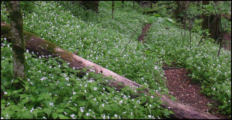
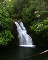
| Photos |
|
| Map |
http://www.georgia-atclub.org/publications/GA-ATMap-Profile.pdf
Includes Elevations
AT in Georgia for Google Maps
AT in Georgia for Google Earth |
| Directions: |
Deep Gap -- Reached via highway US64 and USFS 71. Follow US64 East past Hayesville, NC, make long climb up mountain, and near top of second climb, watch for sign for FS71 on right. FS71 is a 6-mile single-lane gravel road, normally quite passable for autos. Follow FS71 to parking area at end; the AT crosses through this parking area. To go South on AT, head West out of parking area -- to go North, head East. |
|
View Larger Map |
| Reservations: |
Contact Jeremy Landers
770-861-8175
Deadline: Sunday October 23, 2011 - 5pm
*Special Notice Regarding Hikers Under 18 Years of Age!
|
| Post Trip Review: |
|
|
|