Help Support This Website


Hike Info Page
Cooper Gap to Gooch Gap
DO  NOT  CONTACT  THE  CHURCH   OFFICE 
TO  SIGN  UP  FOR  HIKES  NOR  FOR  INFORMATION

CONTACT  THE  HIKE  PLANNER  DIRECTLY
Data Updated: Thursday, September 2, 2010 3:49:34 PM
Status: Confirmed
Notes: This is a catch up re hike of this section. Previously hiked in April of 2008.
Weather: Suches, GA Ten Day Forecast
Dahlonega Ten Day Forecast
Trip: Appalachian Trail

Cooper Gap to Gooch Gap
Date: September 25, 2010
Trip Host: Jeremy Landers
Location: Appalachian Trail
Blue Ridge Wildlife Managment Area
Lumpkin County
Cost: Carry cash for fuel sharing & day use fees.
Difficulty: Moderate
Length: 4.78 Miles Cooper Gap to Gooch Gap
Blaze: White Rectangle (Appalachian Trail)
Departs From: Thompson Bridge Kroger
Dahlonega Walmart (If needed)
Contact Jeremy to add the extra pickups.
Departure Time: 8:00am Thompson Bridge Kroger

8:20am Dahlonega Walmart (If needed)
Meals: Lunch:
Bring a trail lunch & snacks

Don't forget plenty of water!
Transportation: POV's with carpooling, or drive on own. If you need transportation you can post an email to the hike group email list.

(Always be prepared to drive your own vehicle if necessary. If you carpool, fuel costs should be shared.)

Car drop at each trail end.
GPS Info: NA
USGS Quad: Noontoola, Suches
Ranger District: Blue Ridge
Hike
Schedule:
8:00am Thompson Bridge Kroger

8:30am Dahlonega Walmart

8:50am Woody Gap Restroom Break

9:15am Drop vehicle at Gooch Gap USFS 42

9:30am Drop vehicle at Cooper Gap USFS 42 / 80.

9:45 Start hike.

10:45pm Justus Creek

11:15 Blackwell Creek

12: 30 Gooh Gap Shelter (Lunch)

1:45pm Gooch Gap USFS 42

2:15pm Pick up vehicle at Cooper Gap

Return via USFS 42 to HWY 60.

2:50pm Hwy 60 Suches

3:10pm Dahlonega Walmart.

Early Dinner In Dahlonega Optional.

3:45pm Arrive Kroger Thompson Bridge Road, Gainesville.

All times are approximate and are subject to change without notice!*Upon returning from the hike, those who wish to stay for fellowship are invited to join us at the selected location- this is optional and we always understand if you need to depart and return home - be sure and check with your driver as to what their plans will be if you are a rider.

All times are approximate and are subject to change without notice! Direction of travel is subject to change as well.
Trail Description: From Cooper Gap the trail enters the woods and ascends Justus Mountain to its summit at 3336 ft. From the summit, the trail again loses elevation for the next 0.3 miles until it reaches Brookshire Gap (2940 ft). After passing the gap, it follows the ridge over Phyllis Spur (3081 ft) and begins to descend again.
Soon you the trail will join several old roadbeds then crosses Justus Creek. After crossing the creek, the trail continues along the roadbed and rises to cross Blackwell Creek. The area between the two creeks is rich ferns and wildflowers.
After crossing Blackwell Creek, the trail slowly begins to climb through a series of rhododendron thickets. A short blue blazed trail to the left leads to Gooch Mountain shelter. Just beyond the shelter trail, the AT turns abruptly to the right and climbs sharply for 0.2 miles to a high spot on Horseshoe ridge . After the climb, the trail descends to a gap and follows the northern ridge of Gooch Mountain, rising slightly before finally descending to Gooch Gap.
Trip Notes:
In Case Of Emergency Forms (ICE): Last fall we started circulating new ICE forms for each hiker to fill out for emergency contact information. The only part of this form that is required to be completed is the personal contact info for each hiker. We think it would be wise to provide the medical information, but that is optional for each hiker. These forms and the envelope they will be sealed in are bright yellow. If you have not turned in a new ICE form, you will need to do so before you hike. You may contact Marsha or Jeremy to obtain a form. Please have these forms filled out before we meet to hike on April 4th. You can turn them in at the hike site, but it will be best to have them filled out before we gather to hike.
General
Notes:
Walk at your own pace!  Try to walk with someone when possible and try to stay in sight or sound of the main group which means the lead hikers may need to slow or stop to let the rear hikers catch up. This is a good reason to carry a whistle on you at all times. Lead hikers should stop at all trail intersections to let everyone gather before moving forward.

If you need a potty break while on the trail, just let someone know you are leaving the trail for a few moments and have that person wait nearby until you return. If you should feel ill or become weak while hiking, let Jeremy or Marsha know immediately. Do not push yourself forward on the trail under adverse conditions. One of us will work with you to maintain your safety. If you have any medical concerns that need to be known, be certain a hiking partner or Jeremy/Marsha know about any issues that could require immediate attention.

Carpoolers should share the cost of fuel when returning to their base location.

If you have any questions regarding the logistics for this hike, please contact Jeremy Landers. If you are signing up to hike or have transportation issues, contact Jeremy Landers.  More info on our hiking plans can be found at:  www.LandersStudions.com/gechike

PLEASE - DO NOT CONTACT THE CHURCH OFFICE REGARDING THE HIKES. THE CHURCH OFFICE DOES NOT HANDLE OUR PLANS NOR ROSTER FOR THIS ACTIVITY. CONTACT JEREMY OR MARSHA DIRECTLY.

HIKE  AT  YOUR  OWN  PACE - BUT  HIKE  WITH  A  PARTNER  OR IN  SIGHT  OR  SOUND  OF  YOUR  GROUP  FOR  SAFETY.
Links & Ref. http://www.georgia-atclub.org/

Information on Thru-Hiker Certificate & Patch

Certificate Application & Trail Log
http://www.georgia-atclub.org/member/certificate.pdf
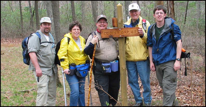
Photos
Map Ga AT Map For Google Maps (NEW)

http://www.georgia-atclub.org/GA-ATMap-Profile.pdf

http://georgiahike.web105.discountasp.net/maps/bin/AT_Hightower_to_Woody.jpg
Includes Elevations
Directions:
Hike Reservations: Required
Deadline September 23, 2010.

Jeremy Landers
770-861-8175

*Special Notice Regarding Hikers Under 18 Years of Age!

Post Trip Review:
Preserve Georgia State Parks

*Special Notice Regarding Hikers Under 18 Years of Age!


Please take a moment to read the Participation Guidlines prior to hiking with the Grace Church Hike Group.

Additional Info For All Hikes
Information provided by Marsha Conner

ICE  INFO
(In Case Of Emergency)

We are now carrying ICE forms with us for safety. The hike planner will
be responsible for being sure these cards are on the trail.  A form in a
sealed yellow envelope with critical contact and medical data on each
hiker will be available in case of emergencies.  You are required to fill
out the emergency contact information however the medical information
is optional, should an emergency arise, this data would go with you for
medical treatment and provide contact information for your relatives
and medical information at the ER that should be known.  Many of us have
ICE phone numbers in our cell phones, but our cell phones may not work
in some wilderness areas.

WHAT  TO  CARRY
You should be self-sufficient on the trail. Do not plan to borrow items you
do not have from people hiking with you. They may not have what you need
or they may need it for themselves. Carefully look over the trail description and
map before going, ask questions, and make sure that you are physically able to
handle the terrain, the temperatures, the possible wetness, and the other
interesting things that might happen to us while on the trail! As always we
set our hiking pace to accomadate everyone. So don't think you'll be too slow.
Jeremy & Marsha are always willing to help you to be trail ready.

1.  Daypack
2.  Water/Fluid Supplies
3.  Food/Snack Supplies
4.  Cash and Photo ID (ID should be on your person at all times)
5.  Other Outdoor Supplies
6. 4 AA Batteries to use in our walkie talkies.

1.  Packs:
a.  Plan and pack for medical emergencies including
     blisters, bug bites, allergies, cuts, etc.
b.  At least one snake bite kit (Sawyer style) should be
     with the group (sold in most sporting goods depts).
c.  Weather change needs such as poncho, emergency
     blanket, cap, gloves, wind jacket, etc.
d.  Cell phone (in case it might work) and other
     items important to you for personal safety or comfort

2.  Water/Fluid Supplies
a.  Plan on carrying a cooler in your vehicle with ice to keep
food and fluids cold throughout the trip
b.  Carry enough fluid with you for the designated trail hike
c.  Do  Not  Drink  Water  From  Streams - most mountain
    water is no longer safe to drink as they may contain
    protozoan imps and make you very sick

3.  Food/Snack Supplies
a.  Short hikes may only require a light snack
     on the trail (1-2 miles) - plan accordingly
b.  Longer hikes usually require a moderate
     snack on the trail (3-4 miles) - plan accordingly
c.  Remember that your appetite is enhanced by
    being outdoors and doing physical activity

4.  Cash and ID
a.  Carry bills in different increments especially "ones"
     for park entrance fees and incidentals - each
     person is responsible for their own fees and should
     share any group cost for parking and fuel
b. The cost of fule is to be shared between driver and
passengers.
c.  For your safety, have your ID with you on the trail at
all times.
d.  Do not leave valuables in your parked car which you
    cannot afford to have stolen!

5.  Other Outdoor Supplies
a.  Camera, Flash Card(s) or film
b.  Binoculars
c.  Sun hat
d.  Knife and compass
e.  Extra socks if prone to blisters
f.  Bug spray
g.  Sting relief especially if you are
     allergic to insect stings
h.  Hiking pole or sticks
i.   Sweat towel and/or bandana
j. Large Pepper Spray (for animal attacks and personal protection)


6. Hunting Season
Remember your Blaze Orange During Hunting Seasons.

UPON RETURNING HOME

1.  Critical - Shower and check your body - CAREFULLY -
     for ticks (if a tick has attached itself to your skin, do
     not crush its body while removing it, but lift it away
     from your skin and pull out by the legs - treat the area
     properly and watch for any redness - if redness appears
     seek medical attention promptly)

2.  Clean and treat any wounded areas of your body -
     use ice for first 24-48 hours on joint/muscle injuries
     and heat as swelling subsides

3.  Consider keeping a log of your hiking experiences and
     write your story in a journal while memories are fresh

4.  Develop pictures and share copies with your hikers

GENERAL  GUIDELINES  TO  REMEMBER

1.  Leave pets at home if hiking with a group. More Info

2.  Keep groups on the trail to no more than 4-6 together

3.  Walk single file in the middle of the trail

4.  Step to the side of the trail as you go downhill
     to allow hikers going uphill to have the right of way

5.  Do not wade with your boots on unless necessary
     Wet socks and shoes can create immediate blisters

6.  Swift water can cause you to lose your footing in
     6-12 inches of water so do not be fooled that you
     can wade without danger across a stream

7.  Snakebites are a critical concern to hikers
     THINK before putting your hands and feet anywhere
     that might be a place of hiding for a snake:
     a.  Step on the top of logs - not over them
     b.  Use your hiking pole to check on the backside
          of logs and rocks before sitting down
     c.  Stay on the trail where visibility is better

8.  Read the many different theories on protection
     from bears and other wildlife - bears are most
     aggressive when protecting their cubs and stay
     near water and food sources frequently - bears
     do not "growl" but will make a "grunting" noise
     to let you know they see you when you may not
     see them - stop, back away slowly, and move
     back down the trail without hesitation - do not
     mistake a "grunting" noise for random woods noise
     on a trail as it may only be made one time to give
     you one chance to back away. Carry a large pepper spray.

9.  Let members of your hiking group know your intentions
    in case you decide to return to the parking lot or leave
     for the day. 

10. Remember that the GEC Open Hike each month will
     have a mixed skill level and cooperation as a team is needed.
     The monthly planner has volunteered to set up the hike
      and there may be slight differences with each hike.
      There is room for both the scenic hiker and the extreme
      hiker with good communication and proper planning.

More information on Hiker Safety can be found at the following websites.
Georgia State Park Safe Hiking Tips

http://www.redcross.org/services/hss/tips/hiking.html


Welcome | 2011 Hike Schedule | Special Events | Participation Guidelines | FAQ | Contact | Subscribe To Our Email List
Photo Gallery | Books | Links & Resources | Grace Episcopal Church Website

This Site Hosted By:
Jeremy R. Landers
&
Landers Photographic Arts

Please Help Support This Site By Visiting Our Webstore Today!

Home - Caricatures - Photography - Store - Search - Order Tracking - Customer Service - FAQ
Contact - About Us - View Shopping Cart - Registered Users Login


LandersStudios.com Landers Photographic Arts Ted Landers

Home of Landers Photographic Arts + Ted Landers Humorous Illustrator

Solution Graphics


Last Modified: Thursday, September 2, 2010