| Data Updated: |
Thursday, October 17, 2013 11:20:12 PM |
| Trip: |
Appalachian Trail
Rock Gap, NC to Tellico Gap, NC - Overnight Backpack Trip |
| Status: |
Confirmed |
| Note: |
THE OVERNIGHT PORTION OF THIS TRIP IS FULL! We cannot accept additional reservations for the overnight portion of this trip at this time! If you would like to be put on the waiting list or sign up for a day hike option please contact Jeremy.
Trip goes rain or shine, unless weather conditions will be severe or extremely wet. |
| Date: |
October 25 - 27, 2013
|
| Trip Host: |
Jeremy Landers
770-861-8175 |
| Location: |
Appalachian Trail
Macon County NC
Nearest City: Franklin, NC
|
| Weather: |
Using the GPS coordinates below use the www.weather.gov or another weather pinpoint forecast for the trail area indicated.
Winding Stair Gap
35.119633
-83.547966
|
Wayah Shelter
35.18945
-83.5644
|
Siler Bald Shelter
35.14421
-83.57247
|
Burningtown Gap
35.222333
-83.562233
|
Wayah Bald
35.18032
-83.56065
|
Tellico Gap
35.268033
-83.57255
|
|
| Cost: |
Carry cash for fuel sharing, emergencies and non trail meals. |
| Difficulty: |
Moderate with some strenuous spots.
See options below for day hike difficulty
|
| Length: |
Complete Hike
23.1 Miles over three days
7.9 Miles on Day 1
8.1 Miles on Day 2
7.1 Miles on Day 3
Optional Day Hikes Only*
Below you will find several options for day hikes ranging in difficulty from easy / moderate to strenuous. If you are interested in any of the options below please let Jeremy know so we can work on the logistics on meetups.
*NOTE:
If you are meeting us at any point it will be VERY critical that you be at the appointed meetup location on time. We will not have daylight hours to wait for your arrival beyond the appointed time. Please let Jeremy know as soon as possible if you are considering a day hike option. Some access is from Forest Service Roads and we will need to plan access logistics.
Friday:
Friday Option #1:
Hike with us from Rock Gap to Winding Stair Gap. Approx 3.7 mile moderate to strenuous one way hike or 7.4 round trip.662 Foot elevation gain in first mile, remainder moderate.
Friday Option #2
Hike with us from US Hwy 64 at Winding Stair Gap to Panther Gap and back. Moderate hike of 4.2 miles round trip.
-----------
Saturday:
Saturday Option #1:
Park at the Wayah Bald Parking area at USFS 69. Hike South on the AT and meet us. Hike can be as far out as you are willing to hike back to your vehicle. Once back to the parking area you can hike up to the fire tower which offers outstanding views. Would make for a good four to five mile hike.
Saturday Option #2:
Park at the Wayah Bald Parking area at USFS 69. Meet us as we come by, then hike to the old stone fire tower, offering outstanding views. Return to your vehicle. 0.4 Round trip easy walk on paved pathway.
Saturday Option #3:
Park at the Wayah Bald Parking area at USFS 69. Meet us as we come by, then hike to the old stone fire tower, offering outstanding views, continue with us until we reach Wayah Shelter. Round Trip hike 2.2 Miles.
Wayah shelter is in memory of Ann & Larry McDuff, brother & sister-inlaw of Grace member Doug McDuff. Ann & Larry were both avid hikers, having hiked many thousand miles together on the Appalachian, Pacific Coast, and Continental Divide Trails. They hiked under the trail name "Annie & The Salesman" and were killed in separate bicycle accidents a few years apart. See "Links & Ref." Below for additional information.
-----------
Sunday:
Park at NC1365 at Tellico Gap, hike in and meet us to hike out together. Again hike in as far as you are willing to hike back out.
*NOTE:
If you are meeting us at any point it will be VERY critical that you be at the appointed meetup location on time. We will not have daylight hours to wait for your arrival beyond the appointed time. Please let Jeremy know as soon as possible if you are considering a day hike option. Some access is from Forest Service Roads and we will need to plan access logistics.
|
| Blaze: |
White Rectangle (Appalachian Trail) |
| Departs From: |
Grace Church |
| Departure Time: |
Friday October 25, 2013
6:30 am Meet up at Grace Church
6:45 am Departs Grace Church
|
| Meals: |
Bring adequate food for 2 breakfasts, 3 lunches, 2 dinners as well as any snacks. You should be prepared to properly store your food overnight to prevent critters & bears from getting your food supply.
(Click Here For A YouTube Video On How To Hang A Bear Bag)
Odor Proof Bags can be purchased at www.simpleoutdoorstore.com
These bags work great!
Please note: ZipLoc bags are NOT odor proof! However using regular ZipLoc bags inside of a larger Odor Proof Bag is a great way to cut down on cost and keep your food separated!
|
| Transportation: |
POV's with carpooling, or drive on own. If you need transportation you can post an email to the hike group email list.
(Always be prepared to drive your own vehicle if necessary. If you carpool, fuel costs should be shared.)
Car Drop at Each Trail End |
| GPS Info: |
The GPS files & related links below are provided as a courtesy. Pleases verify all route & waypoint information before heading out on the trail.
To decompress the Zipped files, you will need a decompression program, such as UnStuffit, WinZip or PKZip.
Rock-Gap-To-Tellico-Gap.gpx (Oct 2013)
GPS / GIS Data From ATC |
| USGS Quad: |
|
| Ranger District: |
Nantahala Ranger Dist. Nantahala National Forest, Formerly the Wayah District . |
| Schedule: |
All times are approximate and are subject to change without notice!
DAY 1
6:30am Meet at Grace Church
6:45am Dept. Grace Church
7:45am Race Trac Clayton, Ga - Restroom Break
8:00am Depart Race Trac
8:45am Day Hiker Car Drop at Winding Stair Gap
9:00am Arrive at Standing Indian Campground, NC Site #13. Restroom Break.
9:15am Depart Standing Indian Campground
9:30am Arrive at Rock Gap - Safety Briefing
9:45am Depart Rock Gap on AT North
10:05am Reach Wallace Gap, Cross old US 64 ascend steps.
12:15pm Winding Stair Gap, US HWY 64, Water, Parking (Optional lunch with day hikers, optional day hiker depart.)
1:00pm Campsite just before Swinging Lick Gap - LUNCH - Day hikers turn back
1:30pm Depart Swinging Lick Gap.
2:15pm (Day Hikers arrive back at Winding Stair Gap & depart for Gainesville)
2:15pm Panther Gap, Campsites no water
3:45pm Southern End of Siler Bald Shelter Trail
4:15pm Siler Bald Shelter (Privy, Water, Cables)
--------Setup camp, filter water, cook supper, etc.... Bed!
6:30pm Approx Sunset
DAY 2
7:49am Approximate Sunrise
8:00am Breakfast, Clean up Breakfast, Re-Supply Water, Break Camp, etc....
9:30am Depart Siler Bald Shelter
9:50am Siler Bald - Enjoy views (Note: Siler Bald can be dangerous in bad weather & fog)
10:15am Depart Siler Bald
11:30am Wayah Crest Picnic Area, (Trash Cans, Parking) (4247ft) Paved NC 1310,
12:15pm USFS 69, Meadow
12:20pm Blue blazed trail to left leads 0.2mile W to Wilson Lick Ranger Station Historic Site.
1:15pm Meadow Campsites & Water LUNCH
1:45pm Depart Meadow
3:00pm Wayah Bald Parking Area USFS 69 (Latrines) HIKER MEET UP. Hikers meeting up with the group should plan to be at this location no later than 2:30pm.
3:15pm Depart Wayah Bald Parking Area
3:30pm Wayah Bald Fire Tower (5342ft)
3:45pm Depart Fire Tower
4:30 Wayah Bald Shelter, Water (Note: Additional camping at Licklog Gap 1.3 mile ahead, has water 0.5 off trail)
5:15 Licklog Gap???
--------Setup camp, filter water, cook supper, etc.... Bed!
6:46pm Approx. Sunset
DAY 3
7:50am Approximate Sunrise
8:00am Breakfast, Clean up Breakfast, Re-Supply Water, Break Camp, etc....
9:30am Depart Licklog Gap (or Wayah Bald Shelter)
10:45am AT turns East at intersection with old road / side trails.
11:30am Burningtown Gap, NC 1397, Parking,
12:15pm Cold Spring Shelter, Privy, LUNCH
1:15pm Depart Cold Spring Shelter
2:00pm Copper Ridge Bald, Views
2:45pm Side Trail to Rocky Bald, views.
4:15pm Tellico Gap, Parking, NC 1365 Otter Creek Road
6:00pm Pick up vehicle at Rock Gap
6:30pm Dinner at Huddle House, Franklin, NC
6:45pm Approximate Sunset
7:15pm Depart Franklin, NC
8:45pm Return to Grace Parking Lot
All times are approximate and are subject to change without notice!
|
| Trail Description: |
Miles by Day
Hiked
Remain |
Miles
To Tellico Gap |
Miles From Rock Gap |
Trail Description |
GPS
(Locations are approximate & unverified)
--
Elevation |
0.0
7.9 |
23.1 |
0.0 |
Parking area at Rock Gap.(3757ft)
Paved USFS 67 leads left one mile to Standing Indian Campground. To right 0.5 mile Wallace Gap. Side trail to right leads 1.7 mile (RdT) to the John Wasilik Memorial Poplar. (This tree, now dead, is the second largest yellow-poplar in the United States, with an 8.6-foot diameter and a 27-foot circumference).
AT bears to right. |
35.094234,
-83.522453
3757 |
0.6
7.3 |
22.5 |
0.6 |
Wallace Gap (3738 ft). The AT crosses old US 64 and ascends a flight of steps. |
35.09802
-83.52663
3738 |
0.8
7.1 |
22.3 |
0.8 |
Cross Stream |
|
1.2
6.7 |
21.9 |
1.2 |
Small level area (campsite). Continue up log steps. |
|
3.1
4.8 |
20.0 |
3.1 |
Cross Stream |
|
3.6
4.3 |
19.5 |
3.6 |
Winding Stair Gap, US Hwy 64, parking areas (2), piped spring east of steps. Trail turns right, follows highway for approx 200 ft. crosses highway, ascends then turns left into woods. |
35.119633
-83.547966
3770 |
3.9
4.0 |
19.2 |
3.9 |
Forest Service Road, Waterfall |
35.12153
-83.54765
3749 |
4.0
3.9 |
19.1 |
4.0 |
Stream Crossing & Possible Campsite |
3814 |
4.3
3.6 |
18.8 |
4.3 |
Logging Road |
4018 |
4.6
3.3 |
18.5 |
4.6 |
Campsite and another stream crossing. |
|
4.8
3.1 |
18.3 |
4.8 |
Swinging Lick Gap. AT makes sharp right. Continue ascent. |
35.12106
-83.55841
4100 |
5.7
2.2 |
17.4 |
5.7 |
Panther Gap. Campsites, NO water. |
4480 |
7.4
0.5 |
15.7 |
7.4 |
Southern End of Siler Bald Shelter Trail. Blue Blazed trail to right leads approx 0.5 mile to Siler Bald Shelter.
AT bears left continuing on old roadbed. Shelter has Privy, Water, Cables. Tent sites in meadow beyond shelter. |
35.140415
-83.57048
4786 |
|
|
|
Siler Bald Shelter |
35.14421
-83.57247
4600 |
7.9
0.0
---
0.00
8.1 |
15.2 |
7.9 |
North end of Siler Bald Shelter Trail. Blue Blazed trail leads right E 0.6 Mile to Siler Bald Shelter.
To left W trail leads 0.2 mile onto Siler Bald and Great views. |
35.142315
-83.576187
5012 |
1.2
6.9 |
14.0 |
9.1 |
Piped Spring |
35.148102
-83.5825653
4477 |
1.5
6.6 |
13.7 |
9.4 |
Footbridge, Stream |
4366 |
1.6
6.5 |
13.6 |
9.5 |
Wayah Crest Picnic Area, "Upscale Privy", Trash Cans, Paved NC 1310 Parking
AT goes straight across road & ascends into the woods. |
35.15395
-83.580733
4247 |
1.7
6.4 |
13.5 |
9.6 |
Wayah Gap, Wayah Road |
35.153904
-83.580223
4180 |
2.1
6.0 |
13.1 |
10.0 |
AT Skirts USFS 69 |
4353 |
2.5
5.6 |
12.7 |
10.4 |
USFS 69, Meadow |
4497 |
2.9
5.2 |
12.3 |
10.8 |
Blue Blazed Trail leading 0.2W to Wilson Lick Ranger Station Historic Site |
4659 |
3.5
4.6 |
11.7 |
11.4 |
USFS 69, Piped spring to right (East) |
5036 |
3.8
4.3 |
11.4 |
11.7 |
Junction with Yellow Blazed Bartram Trail to left. |
5290 |
3.9
4.2 |
11.2 |
11.9 |
Meadow. Campsite & Wine Spring Rd.0.1E. Water on West side of AT |
5290 |
4.2
3.9 |
11 |
12.1 |
Trail bears left off old road, which continues to Wine Spring Road. |
|
5.5
2.6 |
9.7 |
13.4 |
USFS 69 |
5213 |
5.7
2.4 |
9.5 |
13.6 |
Wayah Bald Parking Area. |
35.178301457
-83.56243656
5315 |
5.9
2.2 |
9.3 |
13.8 |
Stone Fire Tower at Wayah Bald |
35.18032
-83.56065
5342 |
6.1
2.0 |
9.1 |
14.0 |
Cross woods road. Bartram trail (Yellow Blazes) turns right here & leaves AT. |
|
6.5
1.6 |
8.7 |
14.4 |
Campsite & spring to left |
4902 |
6.8
1.3 |
8.4 |
14.7 |
Wayah Shelter (East),Water (West 0.2), Privy (GET WATER HERE??) |
35.187794
-83.562023
4759 |
8.1
0.0
---
0.00
7.1 |
7.1 |
16.0 |
Licklog Gap, large campsite area, water (0.5W) |
35.2027
-83.5678
4440 |
1.5
5.6 |
5.6 |
17.5 |
Junction with old roads & side trails at a small clearing. AT turns East. |
4502 |
2.0
5.1 |
5.1 |
18.0 |
Stream |
4313 |
2.3
4.8 |
4.8 |
18.3 |
Burningtown Gap, large clearing, NC1397 Ben Creek Rd. Small parking area for one or two cars. |
35.222333
-83.562233
4236 |
2.7
4.4 |
4.4 |
18.7 |
Spring |
4513 |
3.5
3.6 |
3.6 |
19.5 |
Cold Spring Shelter (LUNCH)
Privy, Water, Campsites are on ridge above shelter |
35.23109
-83.55996
4945 |
4.2
2.9 |
2.9 |
20.2 |
Cooper Ridge Bald, Vista just right of trail |
5080 |
5.4
1.7 |
1.7 |
21.4 |
Side trail 0.1E o Rocky Bald, Views |
5030 |
5.7
1.4 |
1.4 |
21.7 |
Campsite with good spring |
|
7.1
0.00 |
0.00 |
23.1 |
Tellico Gap, Parking, NC 1365. Trail crosses under powerline. Gravel road to left leads four miles to state highway. Road ascending ahead leads to fire tower. AT bears left between the two roads. |
35.268033
-83.57255
3850 |
|
| Equipment Requirements: |
Please note this is a multi day / overnight hike. Each hiker is responsible for providing their own gear (tent, sleeping bag, cookware, food, clothing, rain gear, food storage, first aid, etc....). If you need assistance with equipment please contact one of the co-chairs. |
| Hunting Season: |
Please note that it will be Hunting Season in North Carolina while we will be hiking. |
| General Notes: |
Walk at your own pace! Try to walk with someone when possible and try to stay in sight or sound of the main group which means the lead hikers may need to slow or stop to let the rear hikers catch up. This is a good reason to carry a whistle on you at all times. Lead hikers should stop at all trail intersections to let everyone gather before moving forward.
If you need a potty break while on the trail, just let someone know you are leaving the trail for a few moments and have that person wait nearby until you return. If you should feel ill or become weak while hiking, let Jeremy or Marsha know immediately. Do not push yourself forward on the trail under adverse conditions. One of us will work with you to maintain your safety. If you have any medical concerns that need to be known, be certain a hiking partner or Jeremy/Marsha know about any issues that could require immediate attention.
Carpoolers should share the cost of fuel when returning to their base location.
If you have any questions regarding the logistics for this hike, please contact Jeremy Landers. If you are signing up to hike or have transportation issues, contact Jeremy Landers. More info on our hiking plans can be found at: www.LandersStudions.com/gechike
PLEASE - DO NOT CONTACT THE CHURCH OFFICE REGARDING THE HIKES. THE CHURCH OFFICE DOES NOT HANDLE OUR PLANS NOR ROSTER FOR THIS ACTIVITY. CONTACT JEREMY OR MARSHA DIRECTLY.
Marsha: Email
Jeremy: Email or (770-861-8175 Cell)
Marsha
HIKE AT YOUR OWN PACE - BUT HIKE WITH A PARTNER OR IN SIGHT OR SOUND OF YOUR GROUP FOR SAFETY.
|
| Links & Ref. |
North Carolina Ranger Districts
National Forest Service Alerts - NC
Nantahala National Forest - Wayah District - Motor Vehicle Use Map- PDF
Wayah Bald Fire Tower
|
| Nearest Hospital: |
Angel Medical Center
120 Riverview Street
Franklin, NC 28734
(828) 524-8411
angelmed.org
|
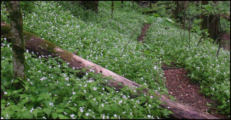
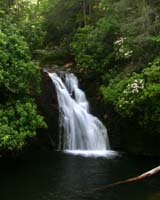
Photos
(NOT GEC Hike Group) |
|
Photos by
GEC Hike Group |
|
| Map |
Nantahala National Forest - Wayah District - Motor Vehicle Use Map- PDF
Interactive AT Map from the ATC
|
| Directions: |
Winding Stair Gap--
From Franklin, NC take US 64 West up & over Winding Stair Gap
View Larger Map
Rock Gap Parking Area -- From Franklin, NC take US 64 West up & over Winding Stair Gap turn left onto Old Murphy Road "Old 64" turn right on paved USFS 67, then 0.5 mile south to parking area. To reach Standing Indian Campground continue on USFS 67 and turn right at campground sign. Proceed to site13
View Larger Map
Wayah Bald Parking Area --
View Larger Map
Tellico Gap --
View Larger Map |
| Reservations: |
Contact Jeremy Landers
770-861-8175
Day Hike Deadline: Sunday October 20, 2013 - 12pm
Overnight Hike Deadline: Sunday October 13, 2013 - 5pm
THE OVERNIGHT PORTION OF THIS TRIP IS FULL!
*Special Notice Regarding Hikers Under 18 Years of Age!
|
| Post Trip Review: |
|
|
|